List of Forest In Kenya
- BeyondForest

- Jun 17, 2024
- 10 min read
Updated: Mar 30
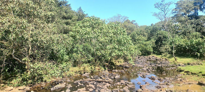
Image of Ragati Forest on Mount Kenya by @EdgeOfLifePhoto
In this post we will talk about
0.)List of Forest and Locations in Kenya
8.)List of exotic trees in Kenya
9.)List of Fruit Trees in Kenya
10.)List of Bamboo Trees in Kenya
11.)List of Fodder Trees in Kenya
1,041 hectare | 2572.367acres | Nairobi County | |
Ololua Forest | 618 hectares | 1527.11 acres | Nairobi County |
Ngare Ndare Forest | 5,554.3 hectares | 13724.97 acres | Meru County |
9.30 hectares | 23 acres | Muranga County | |
Eburu Forest | 8,715.3 hectares | 21535.97 acres | Nakuru County |
Kereita Forest | 4720 hectares | 11663.37 acres | Kiambu County |
Ragia Forest | 4250.21 hectares | 10502.4 acres | Kiambu County |
6,800 hectares | 16803.16 acres | Nyandarua County | |
12997 hectares | 32116.2 acres | Muranga County | |
Kieni Forest | 7953 hectares | 19652.29 acres | Kiambu County |
Njigari Bamboo Forest | 7838 hectares | 19368 acres | Nyeri County |
Nyamweru Forest | Kiambu County | ||
Nyanduma Forest | 26044.907 hectares | 64356.12 acres | Kiambu County |
Kinale Forest | 10540 hectare | 26044.91 acres | Kiambu County |
Ragati Forest | 10477 hectares | 25889.231acres | |
Kirisia Forest | 91944 hectares | 227198.57 acres | Samburu County |
1950 hectares | 4818.56 acres | Kiambu County | |
Kiptunga Forest | 160 hectares | 395.37 acres | |
Cerengoni Forest | 167 hectares | 412.666 acres | Nandi County |
3077 hectares | 7603 acres | Nairobi County |
There are 5 types of forest in Kenya that include montane rainforests, savannah woodlands, dry forests, coastal forests and mangroves.

Image of hikers at Karura Forest
Karura Forest is a 1,041 hectare (2572.367acres ) Forest reserve Located in Nairobi County the Forest is sandwiched between Kiambu road and Limuru road. The Karura Forest itself has 3 main sections which is the Sigiria block , 250 hectares (620 acres) the main forest karura block 710 hectares (1750 acres) and Karura Forest Picnic site 81 hectares (200 acres)

At Karura Forest NCBA tree nursery
Karura Forest was used traditionally for food, fuel and fiber ,as a sacred burial place and a source of herbal remedies ,such as the bark of the famous Muthiga tree. In the year 1932 Karura Forest became a reserve when the colonial government set it aside as source of fuelwood for the new Ugandan Railway
Image of Ololua Forest Gate
Ololua Forest is located in Karen, Nairobi county the forest covers 618 hectares and is home to significant acreage of indigenous trees such as the hardwood Muhugu (Silver oak) and Mutamaiyu (Brown olive) trees.
The Entrance fee to Ololua Forest is Ksh200 ($2) for citizens, Ksh400 ($4) for residents, Ksh600 ($6) for non-citizens and children at half price
Image of Mutarakwa tree at Ngare Ndare forest
Ngare Ndare Forest is located in Meru County .The size of Ngare Ndare Forest is 5,554.3 hectares. To be precise Ngare Ndare Forest is on the border of Laikipia and Meru counties .Ngare Ndare forest is a lush indigenous forest at the northern foothills of Mt. Kenya.Ngare Ndare Forest serves as a migratory route for elephants travelling to and from Mt Kenya forests
Ngare Ndare Forest is the source of the Ngare Ndare river which flows North forming the boundary between Meru and Laikipia before joining Ewaso Nyiro.
Ngare Ndare Forest fee per day cost 2000Ksh and is a very Incredible place. However it's not under KWS hence quite costly and inaccessible to many.
Ngare Ndare in Maasai means water of the goats.
Image of palms along Kiambicho Forest
Kiambicho Forest.Known as Kiambicho Kiamuti Forest Is Located In Maragùa sub county Kiharu constituency, Murang’a County. The size of Kiambicho Forest is 23 acres . The Forest Kiambicho is 19 kilometers away from Muranga town and 6 kilometers away from Sagana town .Kiambicho Forest is one of the dry Forest in Muranga .On the southern edge of the aberdare forest.Though it's a dry forest, it is habitat to animals such as hyenas, antelopes, monkeys, and more. Kiambicho Kiamuti and the Sagana canyons are under the custodianship of the Kenya Forest Service. The trails start to Kiambicho Forest is at the river camp Sagana via a suspension bridge.
While Hiking Kiambicho Forest you can have incredible views of Mount Kilimambogo, the extensive Aberdare range, and the neighboring Mwea Plains.Kiambicho has sections for instance there is Kiambicho Karua Hill A and aslo Karua B
Image of Eburu Forest Eastern Summit
The Eburu forest is a 8,715.3 hectares indigenous forest located in Eburu Mbaruk ward, Gilgil Sub-county,Naivasha,Nakuru county .The Forest Eburu is sandwiched in between Lake elementaita ,Lake Naivasha and Lake Nakuru. The Forest Eburu is mainly made up of indegenous trees such as the Prunus africana and the juniperus procera(mutarakwa)
Eburu Forest is one of the 22 gazette forest blocks that comprise the Mau Forests Complex water tower.
Eburu forest residents are mainly the ogiek community (30,000) who practice Traditional bee keeping . The Ogiek are some of Africa’s last remaining forest dwellers
The Eburu forest is home to the critically endangered mountain bongo antelope, also known as Ghost of the forest .There are less than 100 remaining in the wild. The Mountain Bongo can only be found in four isolated groups at Mount Kenya, Eburu Forest, the Aberdares, and Mau Complex
There are notable initiatives that have been undertaken by organizations to ensure that Eburu forest really maintains its authenticity
Organization such as
1.)Rotaract club of Naivasha planting 5000 trees.
2.)NYSTTI-Naivasha corps
3.)Kenya Forest Service
4.) Globe Gone Green Organization, planting 12,500 indigenous trees
5.)The Rhino Ark / WICZ forest creating a honey joint venture at Eburu Forest
The Kereita Forest,(Kereita comes from the name kiri ita meaning a place of war/warriors).Kereita Forest is located in Kiambu county in a village called Kerita village..Kereita Forest is maintained by (KENVO) Kijabe Environment Volunteers
It is one of the Easiest 10Km forest trails with views of a cave(used as hideouts for the mau-mau) and a waterfall .While trailing you can have very nice views of Elephant Hill and Mt. Kinangop from here.
Kerita Forest is a very rich resource forest as Carbon dioxide mining in Kenya is done at Kereita forest by the famous carbacid company a very huge exporter of C02 gas to 7 countries in africa namely Uganda,Tanzania,Ethiopia,Burundi,Rwanda ,Malawi,Southern Sudan,Somalia.Activities carried out around Kereita forest include Ziplining which is one of the longest ziplines in east Africa a whooping 2km zipline enabling you to view the majestic kereita forest while afloat on air
Image of Ragia Forest Waterfall
The Ragia Forest found in Kiambu county ,Lari is nested at the edge of the Aberdare . The size of Ragia Forest is 4250.21 hectares .The Ragia Forest has two waterfalls the 16 and 17

Image of Bamboo trees at Ragia Forest
To get to the fall you pass a thick forest of bamboo. The scenic sasumwa dam and beautiful nature gives you best experience at Ragia .While at the Forest you can see elephant hill at the background .

Image of Ragia Forest Board
The Entrance Fee To Ragia Forest is 250Ksh while the parking is free although Ragia Forest parking is small fits only 10 cars max
The second waterfall is steep but worth the risk
Image of a Giant Mutarakwa at Mutarakwa Forest
The Mutarakwa Forest or the North Kinangop Forest station occupies a size of 6,800 hectares comprising of dense bamboo, plantations and indigenous forest. Mutarakwa Forest is Located in Engineer,Njambini ,Northern Kinangop in Nyandarua County.Through the Mutarakwa Forest Route its filled with Cypress and pine trees .Mutarakwa Forest Station is the starting point of the hike to Mount Kinangop which is 3,906m (12,815 ft.)
While starting your trail through Mutarakwa forest for the first 2 km you pass through a relatively flat forest and farmland, before you enter the protected forest through a gate on your righthand side. The next 6km ascends up the central Aberdares ridge, through the various vegetation zones. This part of the trail can be muddy (especially after rains) and is also the habitat of occasional buffalos and elephants, whose footprints or droppings may be encountered along the trail.
Image of Kimakia Forest Waterfall
Kimakia Forest is Located in Gatanga sub county in Muranga County.Set in the Southern Aberdares forest. and on the border of Kiambu ,Gatundu . The Kamakia forest covers a size of 12997 hectares with 6,941 hectares under natural forest ,1130 hectares under plantation forest ,4852 hectares under Bamboo plantation .Kimakia Forest is full of indigenous trees like the Juniperus procera(mutarakwa).To access Kimakia Forest you drive through the tea fields of Gatura and Kiarutara.The begining of the hike starts at an old fishing camp and leading to a giant Mugumo tree. From there, multiple river crossings you do cross the beautiful Chania River .The hiking distance through Kamakia Forest is about 15km this is a moderate hike and one has to have had hiking experience.Other common trails along Kamakia forest are Mataara Hike & Gacako Waterfalls
Image of Kieni Forest
Kieni Forest is Located in Gatundu North ,Kiambu County in the southern Aberdares forest, Kieni forest covers a size of 7953 hectares 2,603.60 hectares of Kieni Forest is occupied with Natural Forest while 1,408.30 is mainly plantation forest with 3,589.20 having Bamboo .The Forest Kieni has some unbeaten trails through the dense indigenous forest that leads to 3 spectacular waterfalls.Kieni Forest hike begins at Kieni KFS Station. a Community resource center from where the trail heads into lush tea plantations before descending into the well conserved indigenous forest. The walk through the tea plantation is stunning.
Image of Tea in Kieni forest
The dense indigenous forest provides a cool quiet environment as you get to learn the history of the area, flora, and fauna from informative guides. The trail follows a forest loop that is easily covered in approximately 4-5hours. The hike is 13kms
KFS entrance fee to Kieni Forest is Kshs. 400.

Image of Njigari Bamboo forest
Njigari Bamboo Forest also known as Zuti Forest or Thuti Forest is found near Munyange Two Village in Othaya Nyeri county . Njigari Bamboo forest ocupies a size of 7838 hectares .The Forest lies just on President Kibaki back yard and is very adventorous due to scenic features that the Forest offers .Njigari forest is part of the southern Aberdares Block which includes Njigari Forest, Kihuri Forest, Gatangu Forest, and Gura Forest. Hiking Njigari Forest starts at Njigari Forest Office and ends at Zuti Forest Plant Nursery
Njigari bamboo forest is hard for amateurs and quite tricky to reach the several waterfalls through the thick Bamboo Forest. It’s muddy(when it rains), slippery and a bit steep. The Duration for the Hike is 5-7 hours

Image of Nyanduma Forest
Nyanduma Forest is Found in Kiambu county.The Forest is located in Southern aberdare. Nyanduma means “place of ndumas” because lots of ndumas (arrowroots) are grown in the area .The forest there is Chiboni Waterfall and Gikara waterfall The Trail that leads deep

Image of Kinale Forest
Kinale Forest also known as Old Kijabe is 10,540 hectares is located in Kiambu county and along the Nairobi- Naivasha highway, Kinungi route.

Image of Kinale Forest
Kinale Forest consist of Indigenous forest,bush land ,bamboo,grasslands and forest plantations. The forest has several largely unexplored tourist attractions including Thiririka Water Falls, Theta Dam, breathtaking scenes along the Kikuyu Escarpment, hiking routes through the Old Kijabe center and Kenton Hill View Point.

Image of Kinale Forest
The entrance Fee to Kinale Forest is Ksh 200, whereas campers pay Ksh 650 per person.

Image of Ragati Forest
Ragati Forest is 10,477 hectares and is Located in Nyeri county on the slopes of Mount Kenya . The Ragati forest was gazetted in the year 1943 .
Image of Ragati Forest
Initiatives by The Ragati conservancy in process in Introducing the Mountain Bongo also known as the forest Ghost into the Forest . Ragati Forest has 5,045 hectares under Indigenous trees with 1,323 hectares under plantation area

Image of Ragati forest in Mount Kenya

Image of Kirisia Forest
Kirisia Forest is found in Leroghi Plateau on the western end of Samburu County.The Kirisia forest also known as the Leroghi forest found in Samburu county is one of the largest unfragmented forests in the country and covers a whopping 91,944 Ha consisting mainly of indigenous forests dominated by Cedar (Juniperus procera) Podo (Podocarpus falcatus) and other dry high forest species. Kirisia forest is one of the oldest state forests reserve in Kenya and was gazette in the year 1933

Image of Baawa river in Samburu
Above is Baawa River,a natural River that never dries up in Samburu County Kirisia Forest.The Kirisia Forest is the Most conserved Forest in Samburu.
The entire forest is managed for conservation objectives and it has great environmental, cultural and security significance to the Samburu community.

Image of Ngumbi forest in Kiambu county
The Ngumbi Uplands forest station, situated along the Mai Mahiu Nairobi highway is one of the strategic installations for KFS in the conservation, protection, and preservation of the vast natural forest with cedar (Juniperus procera) as the dominant tree species situated along the escarpment. Ngumbi Forest is located in Lari, Kiambu County. The Ngumbi Forest area is approximately 1950 hectares.
The beat lies within the Kikuyu Escarpment. The area's vegetation is majorly indigenous species with about 100 hectares of cedar while the rest is a natural forest of mixed species and bushland.

Image of Enapuyapui swamp in Kiptunga forest
The swamp Enapuyapui covers 160 hectares .The swamp is the source of Amala and Nyangores Rivers which are the tributaries of the Mara River,a lifeline for the Maasai Mara – Serengeti ecosystem
Kiptunga Forest Station is one of the Fourteen (14) Forest Stations located in Nakuru County. Its a Gazetted Forest with a unique Ecological system which forms part of the Eastern Mau Forest within the larger Mau Forest Complex. It is both an Indigenous and Plantation forest, a water catchment, a rich biodiversity habitat and a precious resource that provides invaluable benefits to people and wildlife.
Kiptunga Forest station covers a total area of 10,363.2 hectares. Altitude ranges from 2400m to 2865m above the sea level.
Kiptunga Forest is significant as it forms an important catchment for Enapuiyapui Swamp which covers an area of 160.6 ha and the main source of River Mara.
The Forest has a rich biodiversity of wildlife species which include Colombus monkey, Dikdik, Hare, Warthogs, Porcupine and Bushbucks as well as several types of birds, insects and reptiles.
The rich Flora in the forest include indigenous tree species such as Juniperus procera,Prunus africana, Podocarpus spp, Olea spp, Croton, Polyscias among other species.
17.)Cerengoni forest station
Cerengoni Forest station is located in Nandi county
18.)Kipkurere forest station
Kipkurere forest station is located in Uasin Gishu
19.)Sabor forest station
Sabor Forest station is located in Elgeyo Marakwet
20.)Baraget Forest
Baraget Forest is Located in Nakuru
21.)Logoman Forest
Logoman Forest is Located in Nakuru
22.) Dundori Forest
Dundori Forest is Located in Nakuru
23.) Menengai Forest
Menengai Forest is Located in Nakuru
24.)Chepalungu forest
Chepalungu Forest is Located in Bomet County
25.)Londiani Community Forest Association
26.)Kampikongoi Forest
27.)Malagat forest station
Malagat Forest is found in Kericho County
28.)Enoospukia forest station
29.)Maasai Mau Forest
The Maasai Mau forest or the Sierra Leone forest is Located in Narok County.


Comments